Meeting point
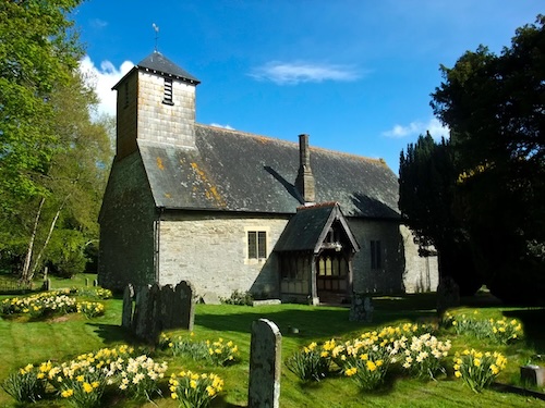
St Thomas a Becket, Huntington HR5 3PY. Grid reference SO 24933 53413. What3words: //driver.crouching.dockers
Description
Bring a packed lunch but tea will be provided at the finish of the walk (for which donations to church funds will be gratefully received). Transport to and from start point by own car. We recommend that you park at Huntington Village Hall car park. Approaching from Kington along Mahollam Road, drive straight on at the crossroads in Huntington Village, and the Village Hall car park is on the right just past the Huntington Castle mound: what3words ///disco.closed.dwarf. From the car park, cross the road and walk down the lane opposite, past The Swan Pub to the church. Allow yourself 5-10 minutes to park and walk to the church.
The walk starts at Huntington’s C13th church. We will pass a kettle hole, tumps and moraines. A discussion with a knowledgeable guide will be had on ancient rocks and traces of a glacial path and the remains of a Motte and Bailey will be visited. The Norman Castle is our last stop before returning to the church. While taking tea, walkers will be able to admire the fine stained glass and the ancient pews in the building.
This walk is sponsored by St. Thomas á Becket Church, Huntington
Overview of the planned route: